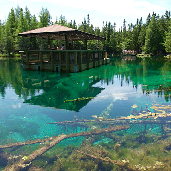
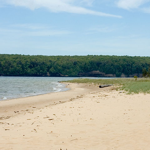
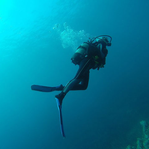
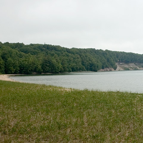
Nature & parks in the Munising and Grand Marais areas
Alger Underwater Preserve
The Alger Underwater Preserve is located on the south shore of Lake Superior near the city of Munising in the Upper Peninsula of Michigan. This area of Lake Superior’s shoreline includes the Pictured Rocks National Lakeshore, Grand Island and the sheltered waters of Munising Bay. The Alger Underwater Preserve offers several unusual diving attractions including “sea caves”, intact shipwrecks, and underwater interpretive trails.
Grand Island National Recreation Area

Grand Island is located in Lake Superior, about one-half mile from the mainland community of Munising, Michigan. The island’s scenic natural beauty and interesting history make it an attractive place for biking, hiking, camping and other outdoor activities. Grand Island Ferry Service has daily departures to the island throughout the summer season.
Hiawatha National Forest – Munising Ranger District office
400 E. Munising Ave., Munising.
(906) 387-2512
fs.usda.gov/recarea/hiawatha/recarea/?recid=13270
Hiawatha National Forest

The Hiawatha is uniquely surrounded by 3 Great Lakes (Michigan, Superior, Huron) that afford it abundantly unique habitats for wildlife, plant species, recreation opportunities, and outstanding visuals, wildlife viewing, and scenic vegetation. We know what makes us special; and we’re ready to share!
Hiawatha National Forest – Munising Ranger District office
400 E. Munising Ave., Munising.
(906) 387-2512
fs.fed.us/r9/forests/hiawatha/
Hiawatha Water Trail

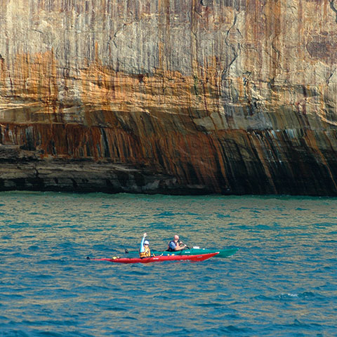
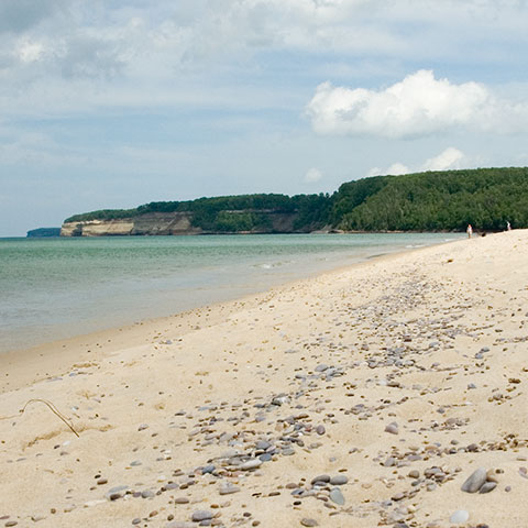
This 120-mile long water trail travels along the Lake Superior shoreline from Big Bay, around Grand Island and over to Grand Marais. It is a kayaker’s dream come true! Visit the website learn more about the access points and the history of the trail.
michiganwatertrails.org/trail.asp?ait=cv&cid=122
Kitch-iti-kipi (The Big Spring)
Michigan’s Largest Freshwater Spring
Short walking trail leads to natural spring pond that features a self-operated observation raft.
Drive east on M28 to Shingleton and then south on M94 to Manistique and US2. Travel west on US2 to Thompson and then north on M149 for 15 minutes. Palms Book State Park, Manistique, MI
N 46° 00.286 W 86° 23.103
»Learn More
Miners Beach
Miners Castle
Miners Castle is the most famous and visited part of the Pictured Rocks National Lakeshore. This unique rock formation is accessible by vehicle and short walk trails. The area has picnic areas, interpretive exhibits and great views of Lake Superior. Also, a favorite destination for snowmobilers in the winter!
Drive 6.5 miles east of Munising on H-58, then head north on Miners Castle Road.
N 46° 29.676 W 86° 33.054
www.nps.gov/piro
Pictured Rocks National Lakeshore
Sandstone cliffs, beaches, sand dunes, waterfalls, lakes, forest, and shoreline beckon you to visit Pictured Rocks National Lakeshore. Hiking, camping, sightseeing, and four season outdoor opportunities abound. The Lakeshore hugs the Lake Superior shoreline for more than 40 miles.
Munising Falls Visitor Center, 1505 Sand Point Rd., Munising
(906) 387-3700
Grand Sable Visitor Center, E21090 County Rd. H-58, Grand Marais
(906) 494-2660
nps.gov/piro
Sand Point Beach
Located within Pictured Rocks National Lakeshore, this sandy beach is a great place to end your day while the sun sets over Munising Bay. Though often too cold for swimming, Sand Point Beach is a quiet place to play in the sand and enjoy the sun. In 2007, The Weather Channel named Sand Point Beach as one of the “Top Five Summer Beaches in America.”
Follow H-58 east out of Munising. Take a left on Sand Point Road and follow to the end of the road. The beach is approximately four miles northeast of Munising.
N 46° 27.013 W 86° 36.401
nps.gov/piro
Seney Wildlife Refuge

The Seney National Wildlife Refuge was established as a refuge and breeding ground for migratory birds and other wildlife. Seney supports a variety of wildlife, including endangered and reintroduced species. Bald eagles, common loons, and trumpeter swans are regularly seen during the summer months, especially June and July, when they are raising their young.
Seney National Wildlife Refuge is located off Highway M-77, five miles south of Seney, or two miles north of Germfask.
(906) 586-9851, ext. 15 for Visitors Center
fws.gov/refuge/seney/
Valley Spur X-Skiing/Biking Trails

Managed by the Noquemenon Trail Network and the Friends of Valley Spur in conjunction with the Hiawatha National Forest, Valley Spur is an Alger County favorite for cross country skiing, hiking and mountain biking. The 27 mile (45 km) cross country ski trail system is groomed 3 to 4 times per week or as the need arises from December through March for both skate and classic ski. Down hill trails are designed with run out and good sight distance, keeping safety in mind. Valley Spur sports a deep snow base which makes for a truly unique skiing and snowshoeing experience. In summer months, many of these loops are used for mountain bike and hiking trails. Trail maps are available at the lodge and are posted throughout the trail system. Day Lodge is staff on winter weekends and its phone number acts as the ski condition hotline.
E8017 State Highway M-94. Located on M-94 approximately 4 miles south of Munising in the Hiawatha National Forest.
N 46° 21.784 W 86° 41.966
(906) 387-4918 (Day Lodge)
valleyspur.org