Skip to content
Facebook-square
Instagram
Home
Contact
Links
Our Store
$
0.00
0
Cart
Lodging
Hotels & Motels
Cabins, Lodges & Resorts
Campgrounds
Attractions
Dining
Lodging
Hotels & Motels
Cabins, Lodges & Resorts
Campgrounds
Attractions
Dining
Shopping
Services
ATM
Banking
Cellular Phone Service
Communications – Telephone/Internet
Marketing
Pharmacy/Medical
Real Estate
Salons/Nail Technicians
Shuttle / Transportation
Visitor Services
Events
Winter
Spring
Summer
Autumn
Shopping
Services
ATM
Banking
Cellular Phone Service
Communications – Telephone/Internet
Marketing
Pharmacy/Medical
Real Estate
Salons/Nail Technicians
Shuttle / Transportation
Visitor Services
Events
Winter
Spring
Summer
Autumn
Web Cams & Weather
Waterfalls
Lighthouses
Nature & Parks
Getting Here
Visitor Center
Web Cams & Weather
Waterfalls
Lighthouses
Nature & Parks
Getting Here
Visitor Center
Store
Home
/
Maps & Guides
/ Hiawatha National Forest Folded Map
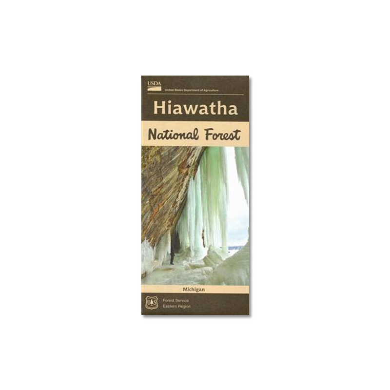
Hiawatha National Forest Folded Map
Folded size: 9″x4″ (standard road map); unfolded 36″x45″
Features Eastern and Western segments of Hiawatha National Forest
Roads, trails, lakes, streams and more are detailed on the map
A great U.P. map for ORV/ATV enthusiasts looking to explore the endless Hiawatha National Forest roads and trails open (or closed) to vehicle traffic
(Price includes shipping & handling. Maps are non-returnable. All sales final.)
Map Features:
State and County roads
Forest Service roads
Trails (Snowmobile/ORV, Hiking, Biking, Canoe)
Recreation sites
Lighthouses
National Forest boundaries
Neighboring State Forest boundaries
Points of Interest: Grand Island inset map
Information on camping — summer and winter
Information about Pictured Rocks and other points of interest
Updated 2018 (most recent version)
$
24.95
Hiawatha National Forest Folded Map quantity
Add to cart
SKU
9.78163E+12
Category
Maps & Guides
Related products
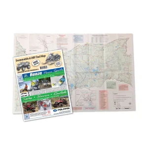
Snowmobile/ORV Trail Maps Bundle
$
35.99
Waterfalls of Michigan Guide Book
$
20.45
–
$
25.95
Price range: $20.45 through $25.95
Snowmobile & ORV Trail Map
$
16.99
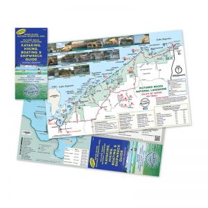
Waterproof Hiking & Kayaking Map
$
8.75
Home
Lodging
Hotels & Motels
Cabins, Lodges & Resorts
Campgrounds
Attractions
Dining
Shopping
Services
Events
Contact
Links
Our Store
Web Cams & Weather
Waterfalls
Lighthouses
Nature & Parks
Getting Here
Visitor Center
Links